

Friday, April 18 – A 7.5-magnitude earthquake struck southern Mexico’s Guerrero state at 36km North West of Tecpan de Galeana Friday morning, the U.S. Geological Survey said.
The USGS report says,
The April 18, 2014 M 7.2 earthquake near the western coast of Mexico occurred in the state of Guerrero, 265 km southwest of Mexico City. The earthquake occurred as the result of thrust motion at shallow depths. The initial location, depth, and mechanism of the April 18 earthquake are broadly consistent with slip on or near the plate boundary interface between the subducting Cocos oceanic sea plate and the North America plate.
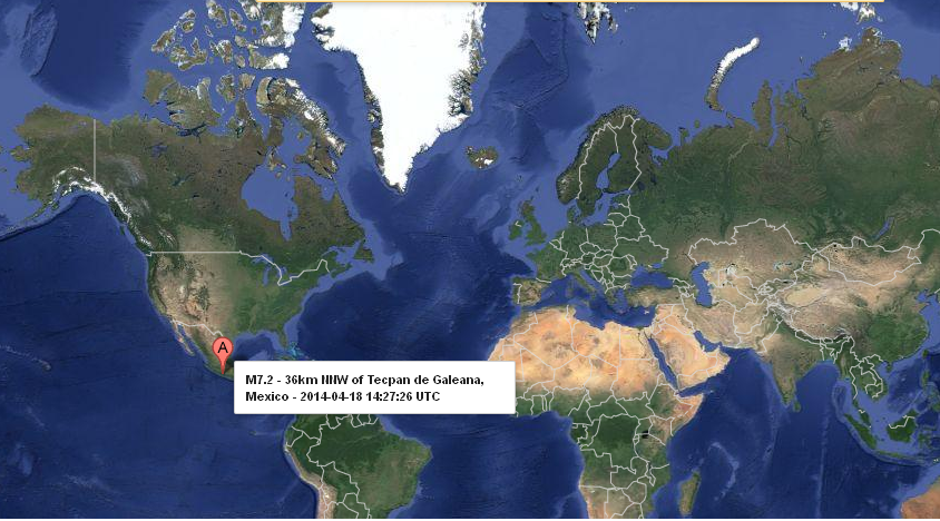
The quake occurred on the Pacific Coast between the major resort towns of Acapulco and Zijuatanejo .
Luis Felipe Puente, head of the Mexican government’s emergency services, said on Twitter there were no immediate reports of damage and the U.S. Pacific Warning Center said it did not expect the quake to trigger a destructive tsunami. And, he alerts about aftershocks.
Located atop three of the large tectonic plates, Mexico is one of the world’s most seismically active regions.
Mexico has a long history of destructive earthquakes and volcanic eruptions. In September 1985, a magnitude 8.1 earthquake killed more than 9,500 people in Mexico City. In southern Mexico, Volcán de Colima and El Chichón erupted in 2005 and 1982, respectively. Paricutín volcano, west of Mexico City, began venting smoke in a cornfield in 1943; a decade later this new volcano had grown to a height of 424 meters. Popocatépetl and Ixtaccíhuatl volcanos (“smoking mountain” and “white lady”, respectively), southeast of Mexico City, occasionally vent gas that can be clearly seen from the City, a reminder that volcanic activity is ongoing. In 1994 and 2000 Popocatépetl renewed its activity forcing the evacuation of nearby towns, causing seismologists and government officials to be concerned about the effect a large-scale eruption might have on the heavily populated region. Popocatépetl volcano last erupted in 2010.